Rio de la Plata
Detail
Date of first edition: 1597
Date of this map: ca. 1597
Dimensions of the map (not including margins): 23 x 29 cm
Dimensions (including margins): 29 x 37,5 cm
Condition: Very good. Centre fold as published. Wide margins.
Condition rating: A+
Verso: blank
Map reference: Van der Krogt 2, 9110:371, page 4 (top right)
From: Descriptionis Ptolemaicae Augmentum
In stock
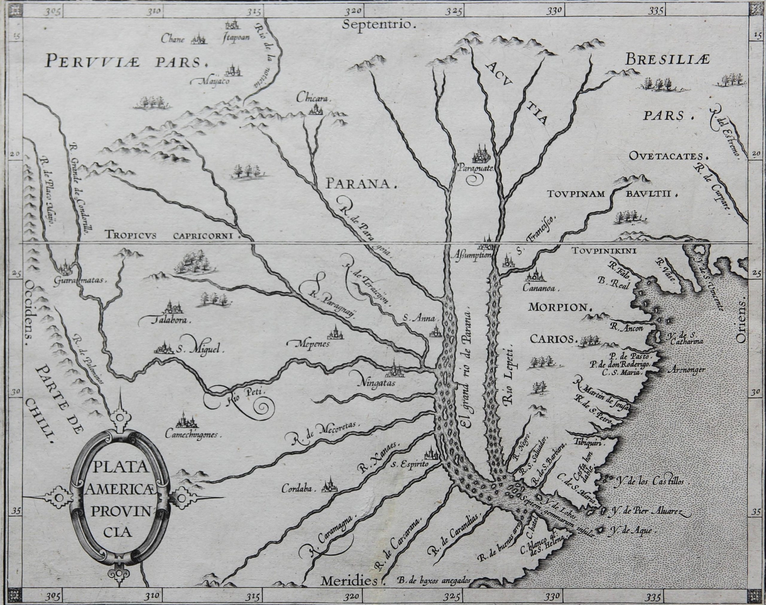
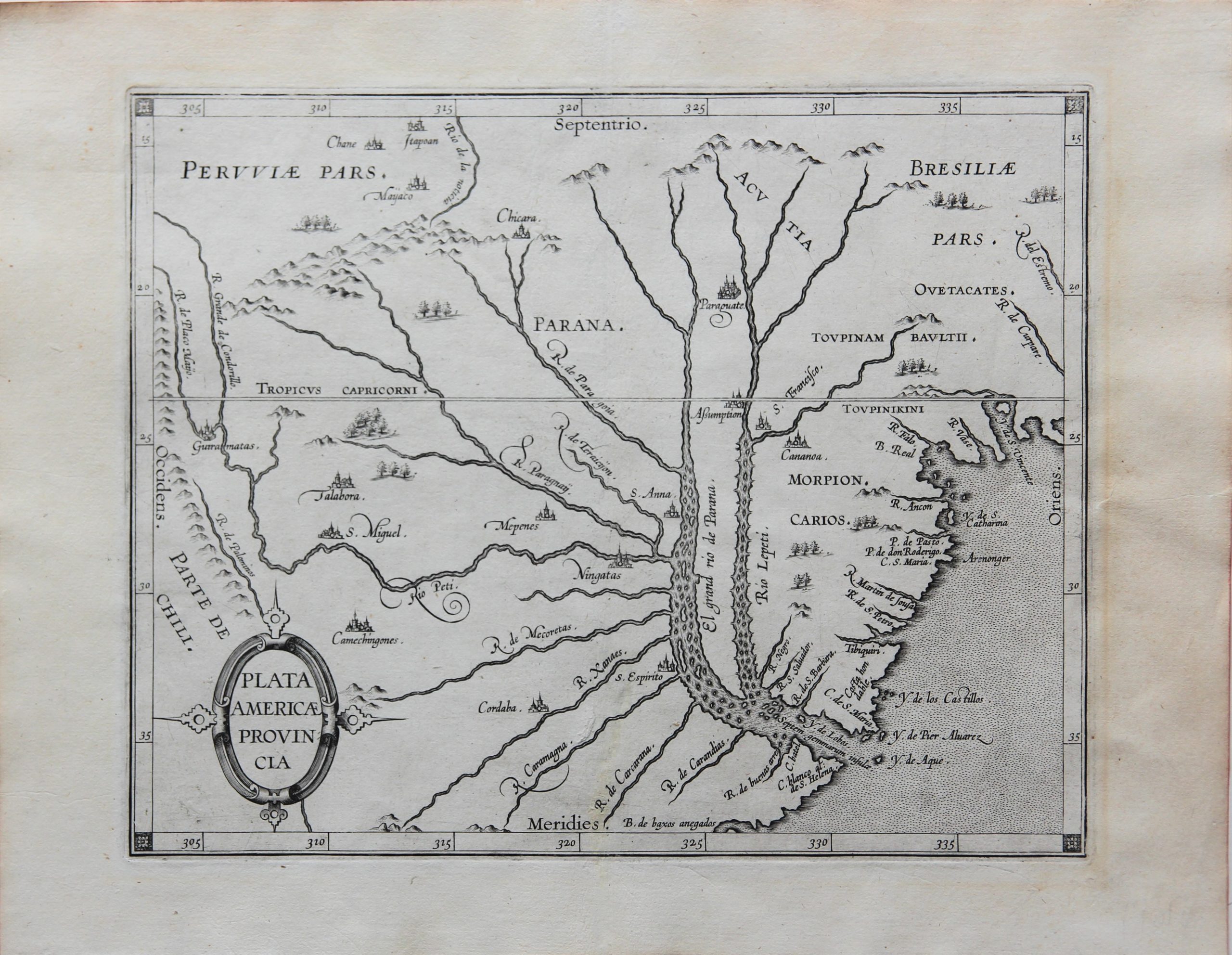
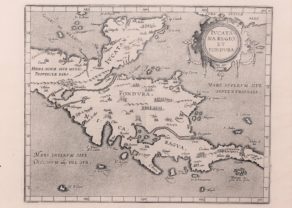
Plata Americae Provinciae by Wytfliet
The map of Plata Americae Provincia does not mention the delta itself by name, but its two feeding rivers, the Parana and the Uruguay (Rio Lepeti). The geographic area covers Central and Northern Argentina (as far as the Andes in the east) and Parte de Chili, Paraguay, Uruguay and Southern Brazil. The opening up of the area was mainly a Spanish matter. This makes sense because under the Treaty of Tordesillas this area belonged to Spain. Juan Diaz de Solis, admiral of the Spanish fleet, was perhaps the first European to explore the estuary (looking for a passage to the Pacific Ocean) and land in Uruguay and Argentina. After the brief exploration by Magellan in 1520, the Italian Sebastian Caboto made an extensive study of the delta and its two main rivers between 1520 and 1526. He sailed down the Parana to the vicinity of Asunción and traded with the Guarani, mainly living in the border area of Paraguay, where he traded silver items, also giving the Rio de la Plata the nickname of “silver river”.
Caboto built the Fort San Salvador, the first settlement in Uruguay, located at the confluence of the Uruguay and Salvador Rivers. At the confluence of the Parana and the Carcarana he erected the short-lived fortress Sancti Spiriti (incorrectly depicted on the map by Wytfliet on the Caramagna). Juan de Ayolas, successor appointed by the Mendoza, founded Asunción in 1537.
Wytfliet also shows, inter alia:
• Y. de S. Vincente, in the far east, now part of the metropole Sao Paolo;
• Cordaba: located more inland which explains its later founding date, namely on July 6, 1573 by Jerónimo Luis de Cabrera, who named the city after the Spanish city of the same name; now the second largest city in Argentina;
• the settlement of Mepenes refers to an Indian tribe that lives in what is now the province of Corrientes, in the north-east of Argentina, so therefore localized a bit incorrectly;
• S. Miguel, the current city of Miguel de Tucuman, important centre in the north of Argentina, founded in 1565 by Diego de Villarroel after an expedition that started in Peru!


Cornelius Wytfliet (? – 1597)
Cornelius Wytfliet was a geographer from Leuven. After graduating Licentiate in Laws from the University of Leuven, Wytfliet moved to Brussels and became secretary to the Council of Brabant.
In 1597 he published the first atlas of America: the Descriptionis Ptolemaicae Augmentum (Augmentation to Ptolemy’s description). He named his work an augmentation to Ptolemy’s Geography because it covers the Americas, a part of the world unknown to Ptolemy. However, there is no other connection between the works of Ptolemy and Van Wytfliet. Dedicated to Philip III of Spain it is a history of the New World to date, recording its discovery, natural history, etc. It provides a history of exploration and the voyages of Christopher Columbus (1492-1502), John Cabot (1497-98), Sebastian Cabot (1526-28), Francisco Pizarro (1527-35), Giovanni de Verazzano (1524), Jacques Cartier (1540-42), and Martin Frobisher (1576-78). Most of Van Wytfliet’s maps are the first or among the earliest of specific regions of North and South America.
For the book, Wytfliet had engraved nineteen maps, one of the world and eighteen regional maps of the Americas. The book was an immediate success and ran to several editions.
Two editions of the Descriptionis Ptolemaicae were published et Leuven in 1597 and 1598. In 1603 appeared the first Douai edition with later editions with French text. The last edition was published in Arnhem in 1615.