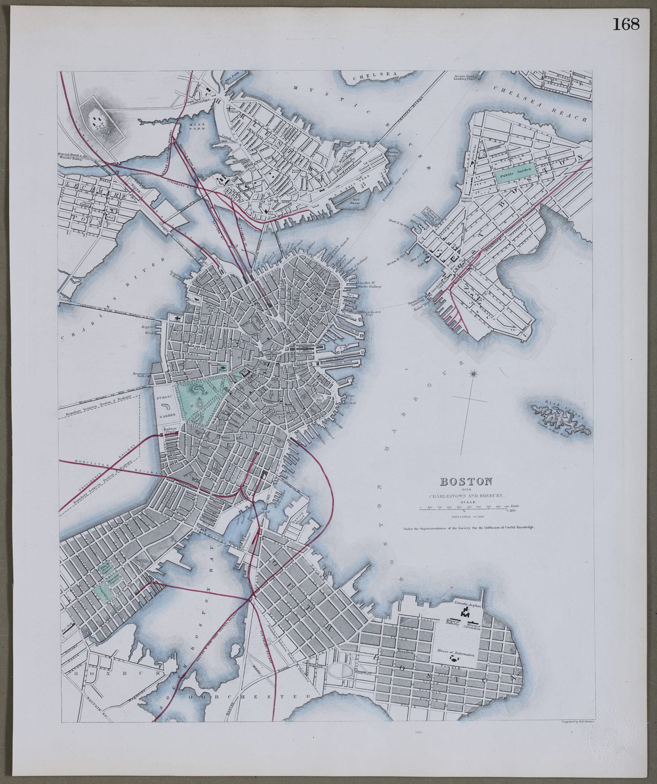
Boston with Charleston and Roxbury
by
SDUK
Detail
Date of first edition: 1844 (most town plans ca. 1830 – ca. 1850 (bound atlases from 1844)
Date of this edition: 1844
Dimensions (not including margins): 30 x 36,5 cm
Condition: excellent. Sharp steel plate printing on paper. Fine original outline colouring. Wide margins.
Condition rating: A+
Verso: blank
Price (without VAT, possibly to be added): €350,00 (FYI +/- $388,50 / £311,50)
Unless otherwise specifically stated on this map page, we charge the following expedition costs in euro (unfortunatelly, gone up with Covid, but still too low in reality!):
– Benelux: 40 euro
– Rest of Europe: 60 euro
– Rest of the World: 100 euro
In stock
SDUK and Boston
The map mentions that the population of the city of Boston was 85.000 inhabitants.
SDUK is short for Society for the Diffusion of Useful Knowledge. The idea for the Society was conceived by Henry Brougham, born in Edinburgh in 1778. In the 1820’s he was actively involved in educational reform and hence the SDUK with the object of publishing information for people belonging to the working class and middle classes who were unable to get formal education or preferred the idea of self education. A map committee was established in 1828. The cheap maps were, however, very accurate in detail. Over a period of 14 years the series expanded to 209 plates with over 3 millions maps being sold; first as part works on subscription and from 1844 in a variety of bound atlases. Up until 1842 the design and engraving was under the direct control of the SDUK using the publishers Balwin and Craddock until their insolvency. From 1842 to 1844 the maps were published by Chapman and Hall, Charles Knight from 1844 to the completion of the series in 1846. Knight continued the publishing until 1852 when the plates were sold to George Cox and then Edward Stanford in 1856. The plates were later acquired by Thomas Letts in 1877 and then finally by Mason & Payne in 1885.