Seville with Giralda
Detail
Date of first edition: 1598
Date of this edition: 1598
Dimensions (not including margins): 37,5 x 49,5 cm
Dimensions (including margins): 40 x 52 cm
Condition: very good. Centre fold as published. Wide margins. Left bottom corner, tiny diagonal fold. Few tiny tears in margins, professionally repaired. Nice colouring.
Condition rating: A+
Verso: text in Latin
Map reference: Van der Krogt IV-2,2 3849; Taschen Br Hog, p. 350
From: Civitatus Orbis Terrarum, V. Van der Krogt IV-2,2 3849
In stock
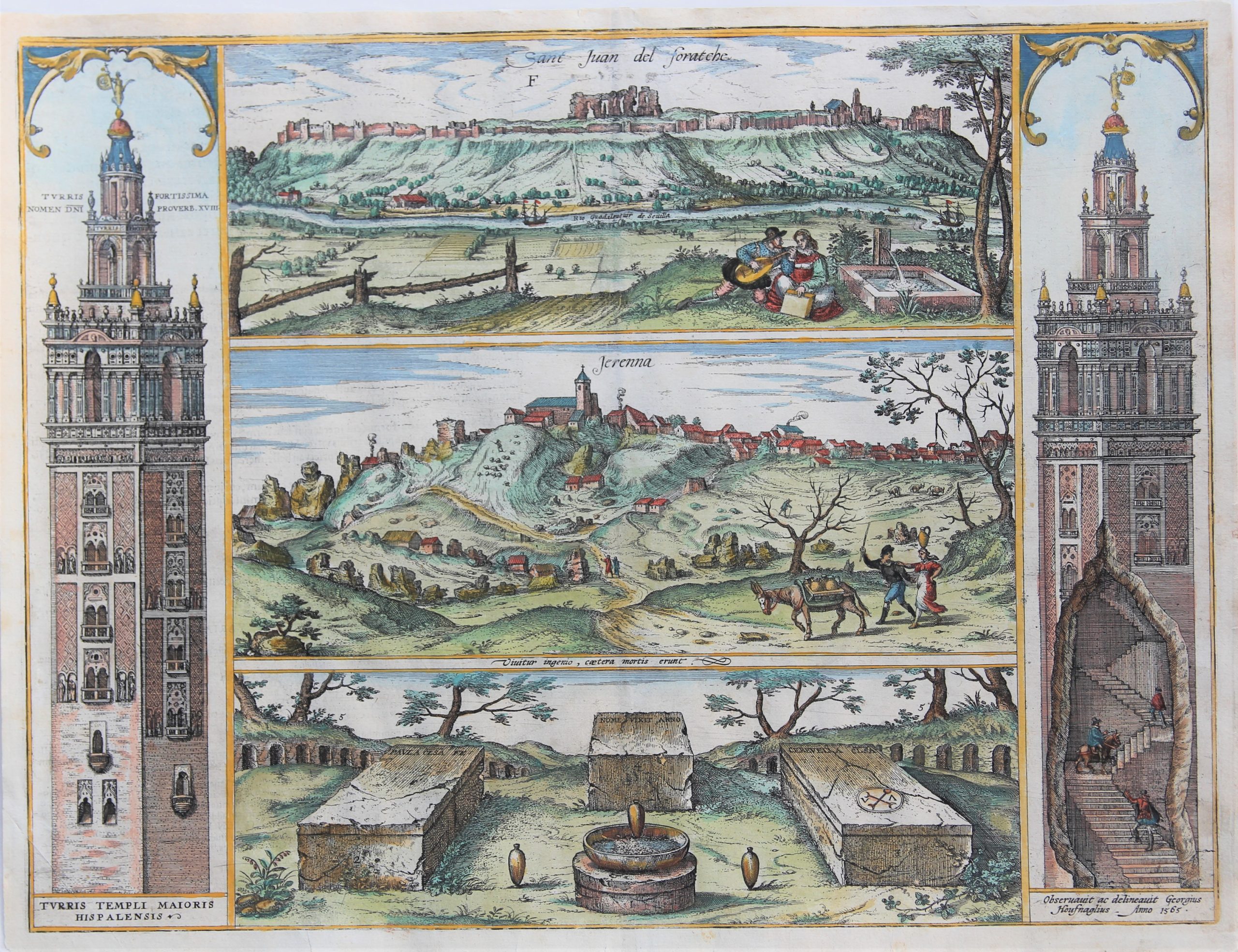
Seville commented by Braun
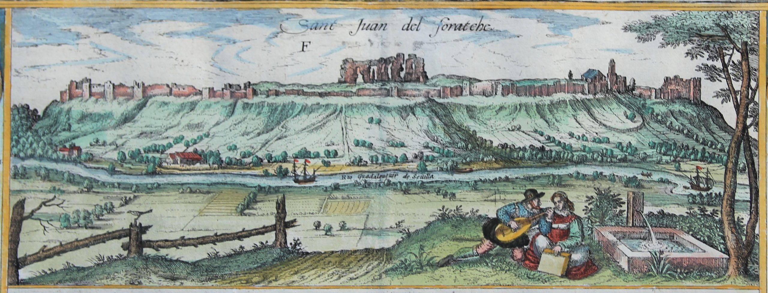
Not far from Seville lies San Juan de Aznalfarache with the ancient ruined walls of an incredibly large palace. The site lies on a hill on the River Bétis, called the Guadalquivir from the Arabic, meaning big river. Even today, simple brick-vaulted tombs are uncovered in great numbers by the daily ploughing of the fields in front of Seville. The Moors, when they still ruled Hispania, built other such towers out of brick with such artistry that anyone who sees them must be astonished.”
Taschen on Greater Seville
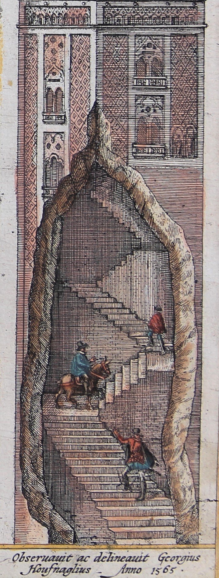
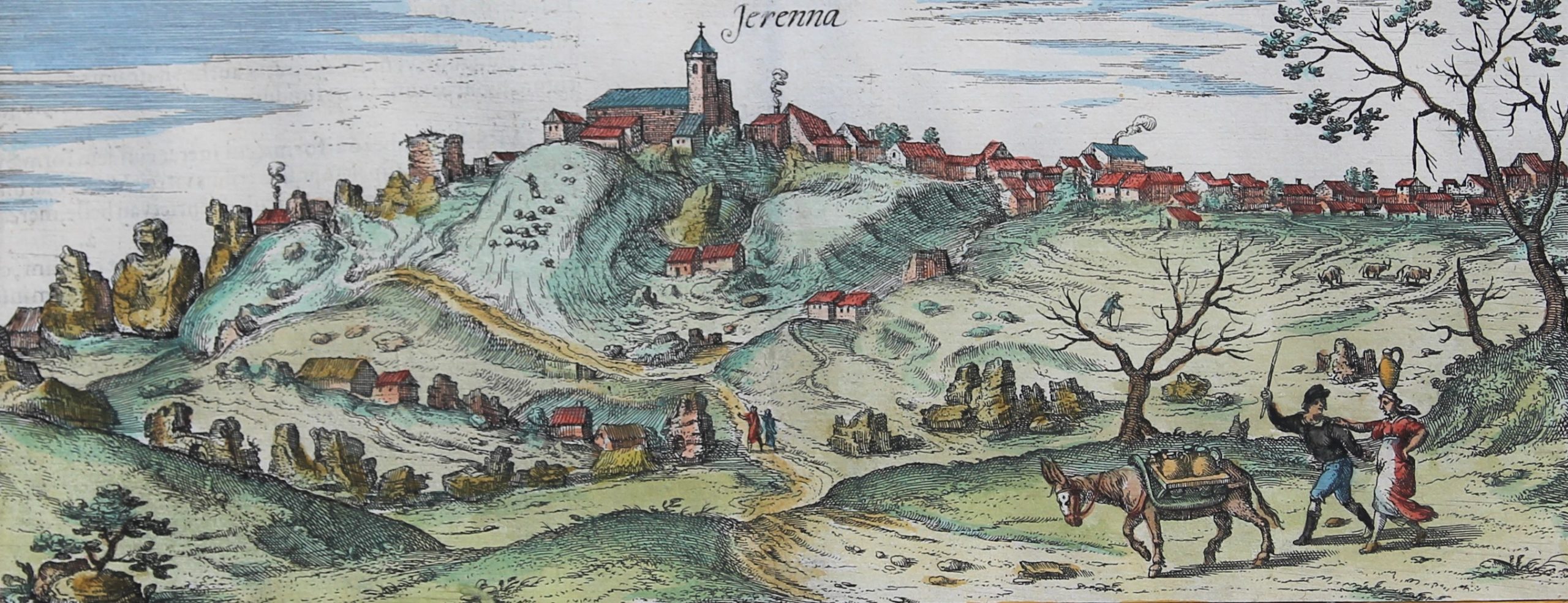
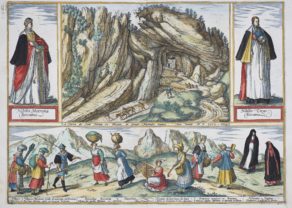
The plate illustrates three sites in the immediate vicinity of Seville, framed on either side by views of the Giralda, the famous bell tower of Seville cathedral. Still the city’s most familiar landmark, the Giralda is shown on the left in a façade view, while on the right a cut-away view reveals the tower’s internal staircase, a ramp that could be ridden up on horseback. The Giralda was originally the minaret of the Mezquita Major, commenced in 1172. After the Reconquista, however, the Moorish mosque was replaced by the cathedral of Santa Maria de la Juan de Aznalfarache, southwest of Seville. During the Muslim Al-Andalus period (from the 8th cent. onwards) it was called Hisn-al-Faray, which means “castle with a view” and is the origin of today’s Aznalfarache. The castle in question was built in 1196/97. In 1248, after being reconquered from the Moors, the site passed to the Order of St John (San Juan) of Jerusalem, hence the first part of the town’s name. The middle view shows the hilltop village of Gerena, northwest of Seville. The town goes back to a Roman settlement and many Roman remains are still to be found there. These include sections of an aqueduct, which carried water to the Roman city of Italica. The aquaduct and the ruins of Italica are probably the subject of the lower view. Italica was founded in 206 BC by Publius Cornelius Scipio Africanus and was used as a quarry after the arrival of the Moors in 711. As a vanitas motif above the tombs, Hoefnagel has included an antique motto taken from the Appendix Vergiliana and widespread within humanism: Vivitur ingenio caetera mortis erunt – “


Seville today
What to discover on this complex map?
First of all one notices the two views of the fabulous bell tower of the Giralda; left and right. The right cutaway shows Hoefnagel ascending on horseback.
The top view shows San Juan de Aznalfararche today, just across the river:
Despite being a separate municipality, San Juan is in the metropolitan area of Seville, to which it lies on an opposite bank of the Gualquivir River. The city is linked by two road bridges and a pedestrian one to the Sevillian district of Triana on the Isla de La Cartuja.
The middle view shows the hilltop village of Jerenna (now Gerena), today a small village some 10 km northwest of Seville.
Bottom view of the cemetery with three Roman tombs and urns: ” Viuititur ingenio, caetera mortis erunt” : Intellignce lives, the rest is mortal!