Strasbourg – Argentoratum or Straszburg
Seat of the EU Parliament
Detail
Date of first edition: 1572
Date of this edition: 1575
Dimensions (not including margins): 34 x 42 cm
Condition: Good. Sharp copper engraving printed on paper. Old coloured. Centre fold as published. Wide margins.
Condition rating: A+
Verso: text in Latin
Map reference: Taschen, Braun and Hogenberg, p.98; van der Krogt IV-2,2, 4169
From: Civitates Orbis Terrarum, Liber Primus, 1575; van der Krogt IV,-1, p. 83; ‘Dagoberto &c with line below initial ‘soluendis’
This item is sold
Strasbourg
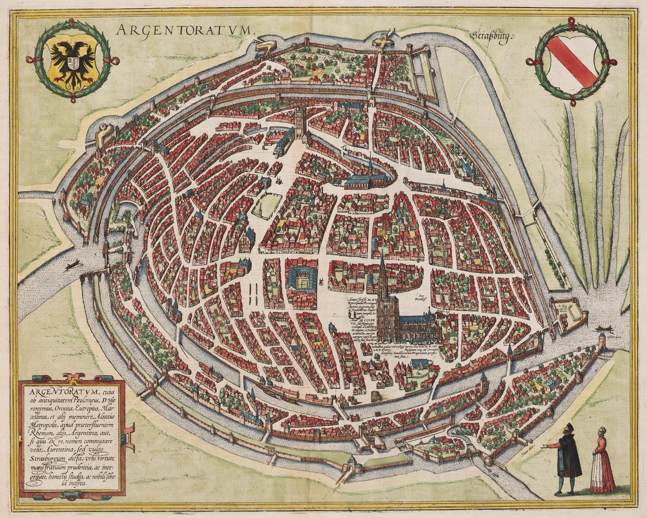
CARTOUCHE: Strasbourg, mentioned since antiquity by Ptolemy, St Jerome, Orosius, Eutropius, Marcellinus and others, is the capital of the Alsace, on the nearby flowing Rhine, called by others Argentina or Aurentina but Strasbourg by the ordinary people. A city widely famed for the virtue, prudence and integrity of the magistracy, respected scientific studies and a well-known school.
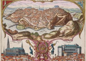
Strasbourg is seen from a bird’s-eye perspective in a plan view in which the blocks of houses are markedly contracted in favour of the broad streets and squares. The north tower, 142 m high and built from 1227 to 1439, made the cathedral the tallest Christian church right up to the 19th century. In 1262 the city was declared a Free Imperial City, of which there were seven in total, and profited from many privileges and a certain independence. From the 14th century onward it formed a major economic and cultural centre, with close links to cities of Upper Italy.
Copper engraving after a map by Conrad Morant, 1548. Not just the view of the city but also the Latin texts were taken over verbatim. Morant has been shown to have collaborated c. 1550 on Munster’s Cosmographia so that there are also similarities with the woodcut there.
Related items
-

Frankfurt
by Georg Braun and Frans HogenbergPrice (without VAT, possibly to be added): €950,00 / $1 054,50 / £845,50 -

Paris – Lutetia
by Georg Braun and Frans HogenbergPrice (without VAT, possibly to be added): €2 800,00 / $3 108,00 / £2 492,00Paris s’éveille
-

Marseille
by Georg Braun and Frans HogenbergPrice (without VAT, possibly to be added): €700,00 / $777,00 / £623,00
Strasbourg by Braun and Hogenberg
The Roman camp of Argentoratum was first mentioned in 12 BC.
Strasbourg is seen from a bird’s-eye perspective in a plan view in which the blocks of houses are markedly contracted in favour of the broad streets and squares. The North Tower of the cathedral, 142 m high and built from 1227 to 1439, made it the tallest Christian church right up to the 19th century. In 1262 the city was declared a Free Imperial City, of which there were seven in total, and profited from many privileges and a certain independence. From the 14th century onward it formed a major economic and cultural centre, with close links to cities of Upper Italy.
This Alsatian capital at the Rhine River was fought over so many times between France and Germany (see the Habsburg double-headed eagle, top left). As a sign of reconciliation it became the seat of the EU Parliament but also of the lesser know Council of Europe, the continent’s leading human rights organisation. It includes 47 member states, 27 of which are members of the European Union.
But also the Central Commission of the Navigation of the Rhine and the EU Eurocorps are based here.
Below a picture of its majestic cathedral:
Strasbourg remained an important city:
In chronological order, notable people here born, include: Sebastian Brant (German humanist and satirist), Jean Baptiste Kléber and François Christophe Kellermann (both generals under Napoleon), Marie Tussaud (maiden name Grosholtz, opened the first wax museum in London) and Arsène Wenger (success coach of Arsenal)
In chronological order, notable residents of Strasbourg include: Hans Baldung Grien (or Grün; student of Dürer), John Calvin, Johann Wolfgang Goethe, Klemens von Metternich, Louis Pasteur, Albert Schweitzer and Otto Klemperer
And last but not least, quite to the contrary, its most gifted son: Johannes Gutenberg (1400 – 1468) revolutionized printing in Europe. And so, he indirectly became essential to the printing of maps in the 15th century…