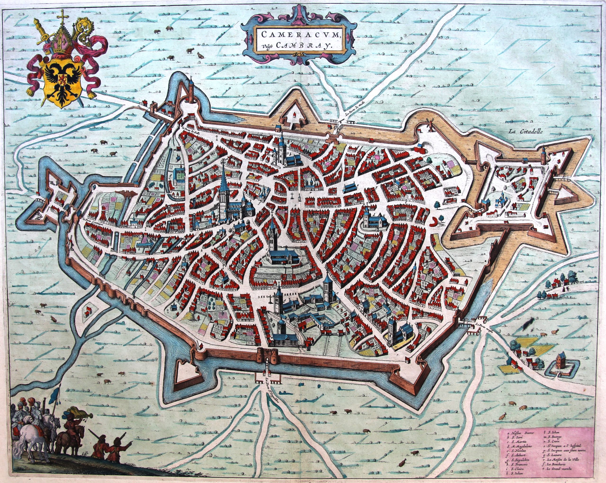
Cambrai – Cameracum vulgo Cambray
by
Joan Blaeu
Detail
Date of first edition: 1649
Date of this map: ca. 1660
Dimensions (not including margins): 41,5 x 52,5 cm
Dimensions (including margins): 49 x 61 cm
Condition: Very good. Copper engraving on strong paper and wide margins. Centre fold as published. Old colouring.
Condition rating: A+
Verso: text in Latin
From: Novum Ac Magnum Theatrum Urbium Belgicae. (= “Stedeboeck”) Amsterdam, J. Blaeu, 1649. Koeman, Bl63
Price (without VAT, possibly to be added): €370,00 (FYI +/- $410,70 / £329,30)
Unless otherwise specifically stated on this map page, we charge the following expedition costs in euro (unfortunatelly, gone up with Covid, but still too low in reality!):
– Benelux: 40 euro
– Rest of Europe: 60 euro
– Rest of the World: 100 euro
In stock
Little known…
Little is known with certainty of the beginnings of Cambrai. Camaracum or Camaraco, as it was known to the Romans, is mentioned for the first time on the Peutinger in the middle of the 4th century. It became the main town of the Roman province of the Nervii, whose first Roman capital had been at Bagacum, present-day Bavay.
The city lies at the headwaters of the Scheldt and the old town is built on the right bank who climbs the hill to the east where today stands the citadel.
In 1543 Emperor Charles V added the city to the Habsburg Netherlands. In order to defend the city against the threat from France he built a citadel on the hill where once stood the Saint-Gery abbey. In 1559 the church was redesigned format in the Netherlands (as a measure of the Catholic Counter-Reformation politics after the Council of Trent). Cambrai was next to Utrecht and Mechelen, the seat of an archdiocese, especially for almost all French Dutch provinces. By the Treaty of Nijmegen of 1678, Spain had relinquished Cambrai, which has remained as a part of France, to this day.
It goes without saying that Cambrai tremendously suffered during WWI and WWII, each time (1914, 1918, 1940, 1944) attacked by both sides.