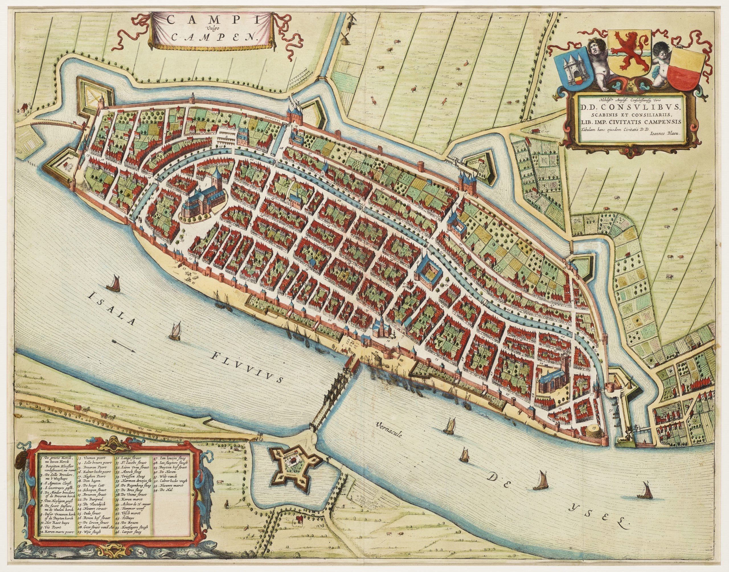
Kampen – Campi vulgo Campen
by
Joan Blaeu
Detail
Date of first edition: 1649
Date of this map: 1649
Dimensions (not including margins): 43,5 x 55 cm
Condition: Very good. Strong paper and wide margins. Soft old colouring.
Condition rating: A
Verso: text in Latin
From: Novum Ac Magnum Theatrum Urbium Belgicae Liberae Ac Foederatae. Amsterdam, J. Blaeu, 1649. (Koeman, Bl62)
Price (without VAT, possibly to be added): €600,00 (FYI +/- $666,00 / £534,00)
Unless otherwise specifically stated on this map page, we charge the following expedition costs in euro (unfortunatelly, gone up with Covid, but still too low in reality!):
– Benelux: 40 euro
– Rest of Europe: 60 euro
– Rest of the World: 100 euro
In stock


Kampen, a Hanseatic city
Kampen thanks its historical importance to its location: the IJssel river is a connection between the Rhine and the IJsselmeer. In fact, the IJssel is nothing less than a branch of the Rhine! Since the 12th century the Northern and Western European trade expanded enormously. Some pioneers organised an first trade conference in Lübeck in 1356, whihc lay the basis for the Hanseatic League. At its peak, the Hansa had 150 members.
Around the IJssel the following cities belonged to the trade association: Hattem, Zutphen, Doesburg, Zwolle, Deventer and Kampen (member since 1441). The peak of the organisation coincides to the flourishing of Kampen between 1330 and 1450. From 1430 the river started to silt. In the 18th century it was agreed that the IJssel was entitled to 1/9 of the downstream Rhine water. The permanent bridge over the river was built from 1448, albeit under protest from the upstream cities: it would hinder their economic importance.
When Joan Blaeu published this map, the city had long passed its economic peak.