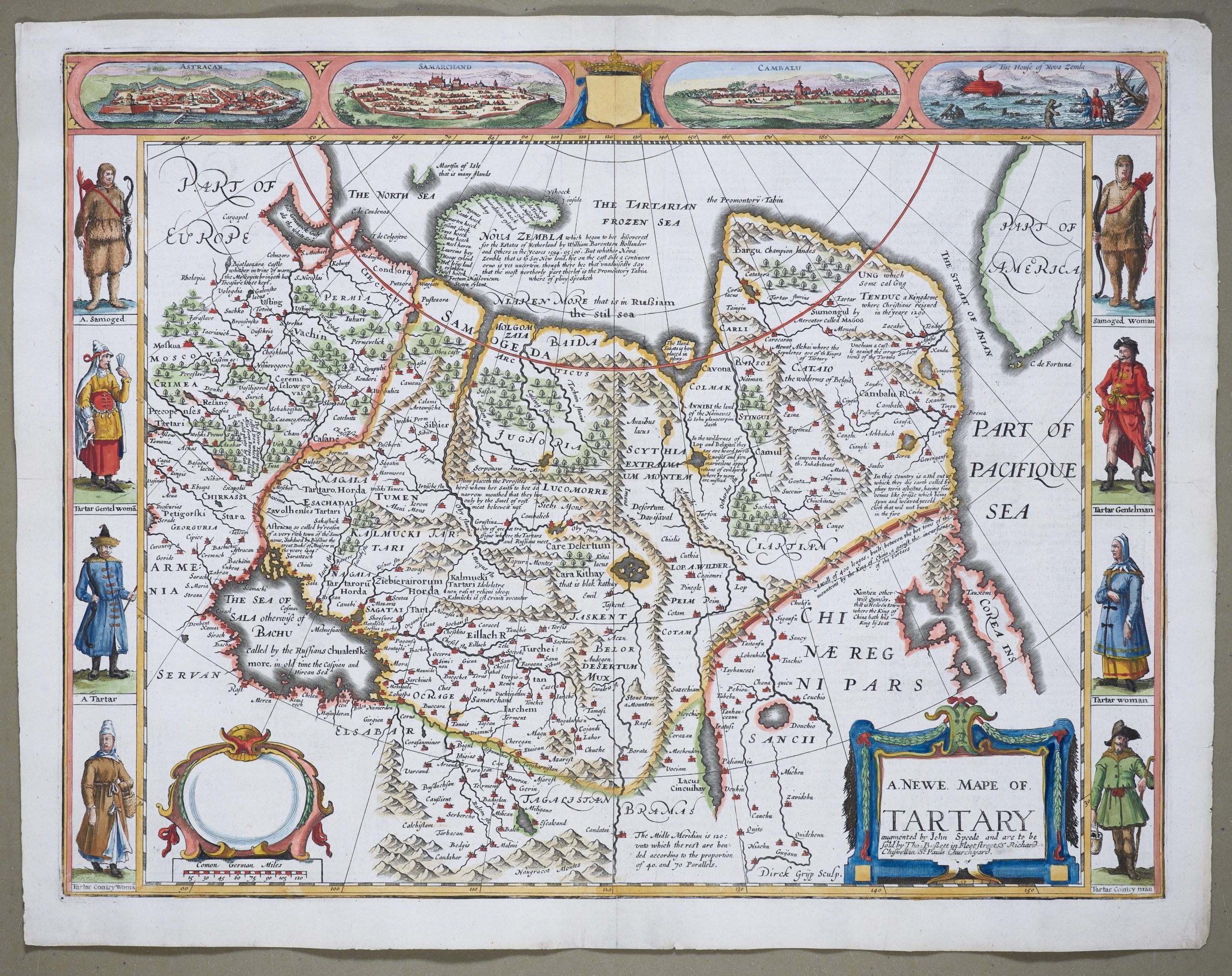
Tartary – A Newe Mape of Tartary
by
John Speed
Detail
Date of first edition: 1627-1676
Date of this map: 1627-1676
Dimensions (not including margins) with the text around: 38,6 x 51,5 cm
Condition: very good. Minor reinforcement to centre fold; further centre fold as published. Nice colouring.
Condition rating: A
Verso: text in English
From: Prospect of the Most Famous Parts of the World
Price (without VAT, possibly to be added): €2 000,00 (FYI +/- $2 220,00 / £1 780,00)
Unless otherwise specifically stated on this map page, we charge the following expedition costs in euro (unfortunatelly, gone up with Covid, but still too low in reality!):
– Benelux: 40 euro
– Rest of Europe: 60 euro
– Rest of the World: 100 euro
In stock


Tartary by John Speed
The only carte-à-figures map of central and northern Asia was published in the “Prospect of the Most Famous Parts of the World – the first world atlas produced in England. John Speed’s map is based on Dutch originals (e.g. Ortelius map), but has the addition of side panels depicting costumed figures, while above are vignettes of the Silk Road cities of Astrakhan, Samarkant and Cambalu, with an illustration of the “house in Nova Zembla” (Baretnsz winter house of survival). The Great Wall is clearly seen, and the interior is heavily annotated. Speed also shows the Strait of Anian (Bering Strait) and a part of Alaksa.