Edo (Tokyo) – Platte Grond van Jedo
by
Jacobus van der Schley
Detail
Date of first edition: ca. 1757 (after Jacques Bellin)
Date of this map: ca. 1757
Dimensions (not including margins): 26 x 25 cm
Condition: Very good. Strong paper and wide margins . Vivid colours.
Condition rating: A
Verso: blanc
From: L’Histoire générale des voyages of Antoine François Prévost, published by De Hondt, 1747-1767
Price (without VAT, possibly to be added): €250,00 (FYI +/- $277,50 / £222,50)
Unless otherwise specifically stated on this map page, we charge the following expedition costs in euro (unfortunatelly, gone up with Covid, but still too low in reality!):
– Benelux: 40 euro
– Rest of Europe: 60 euro
– Rest of the World: 100 euro
In stock
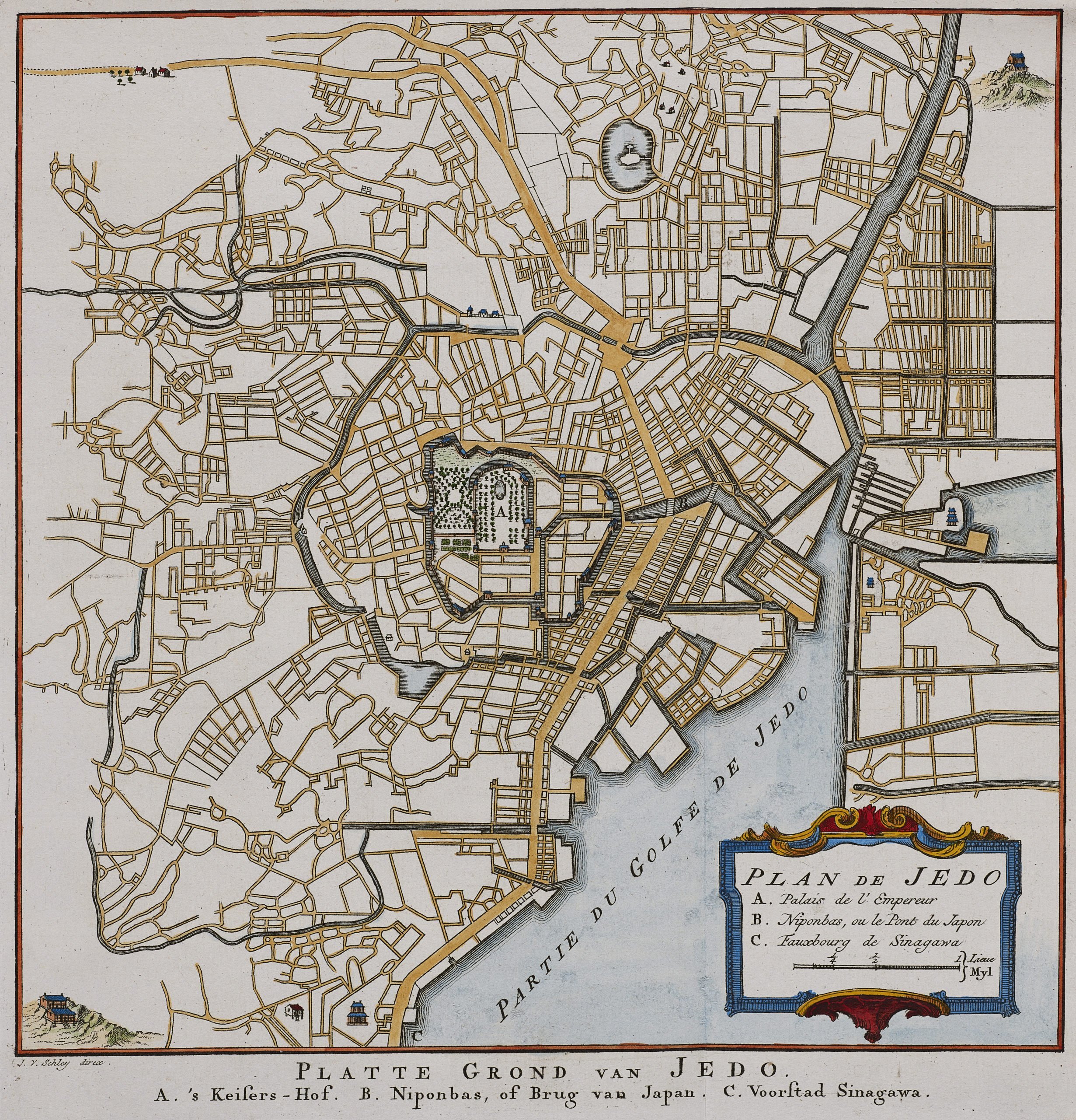
Still shogun time
Edo was the name of the town under the rules of the shogunate.
So, this small map shows “Tokyo” at the time of the shogunate, which lasted until Emperor Meiji restored his power in 1868.
The large open space in the centre of the town is the location of the castle of the shogun. After the revolution the Emperor built his palace on the same spot.