Ancient Portus (near Ostia), Rome’s imperial harbor
Portus, the key Roman port in imperial times
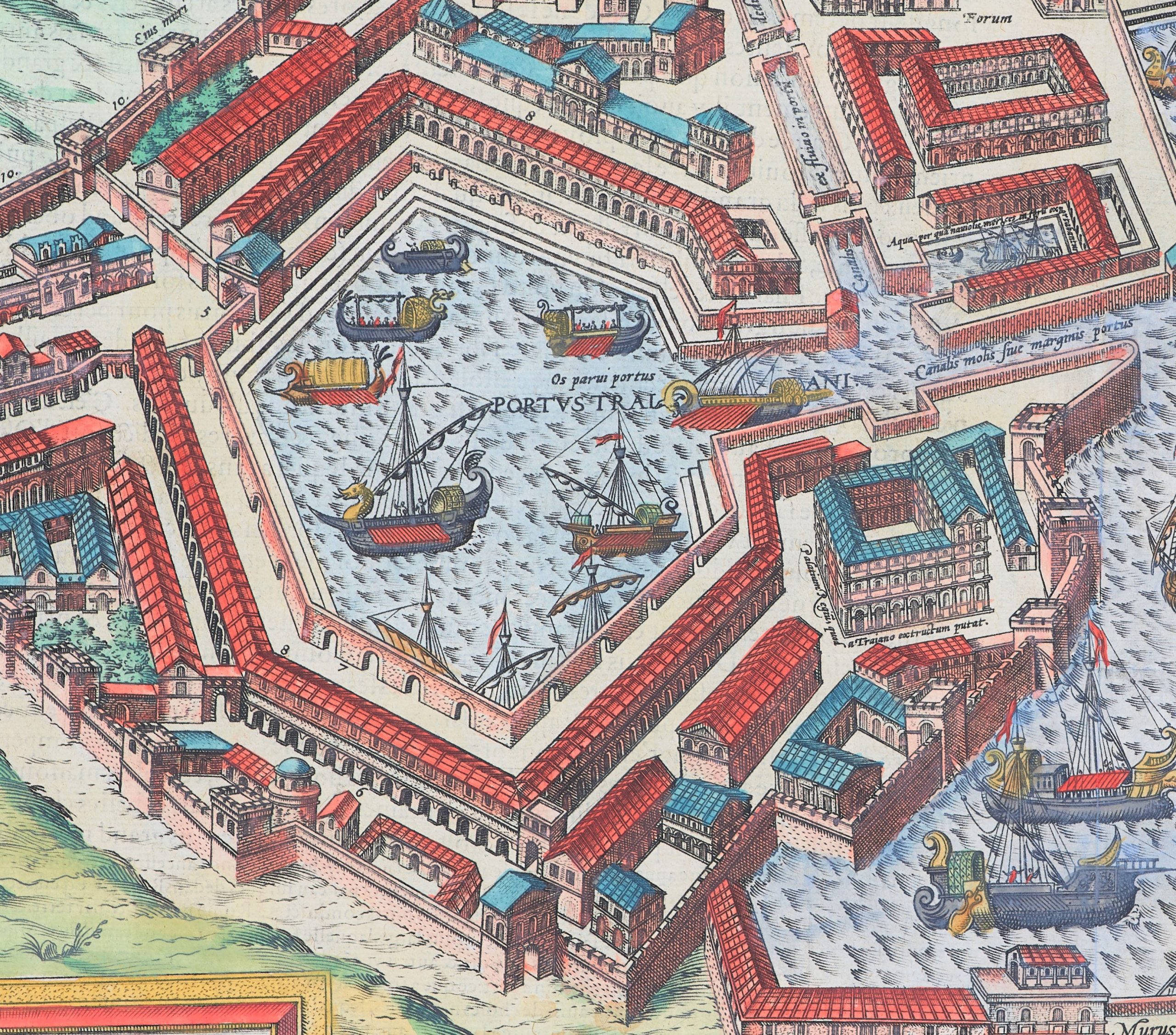
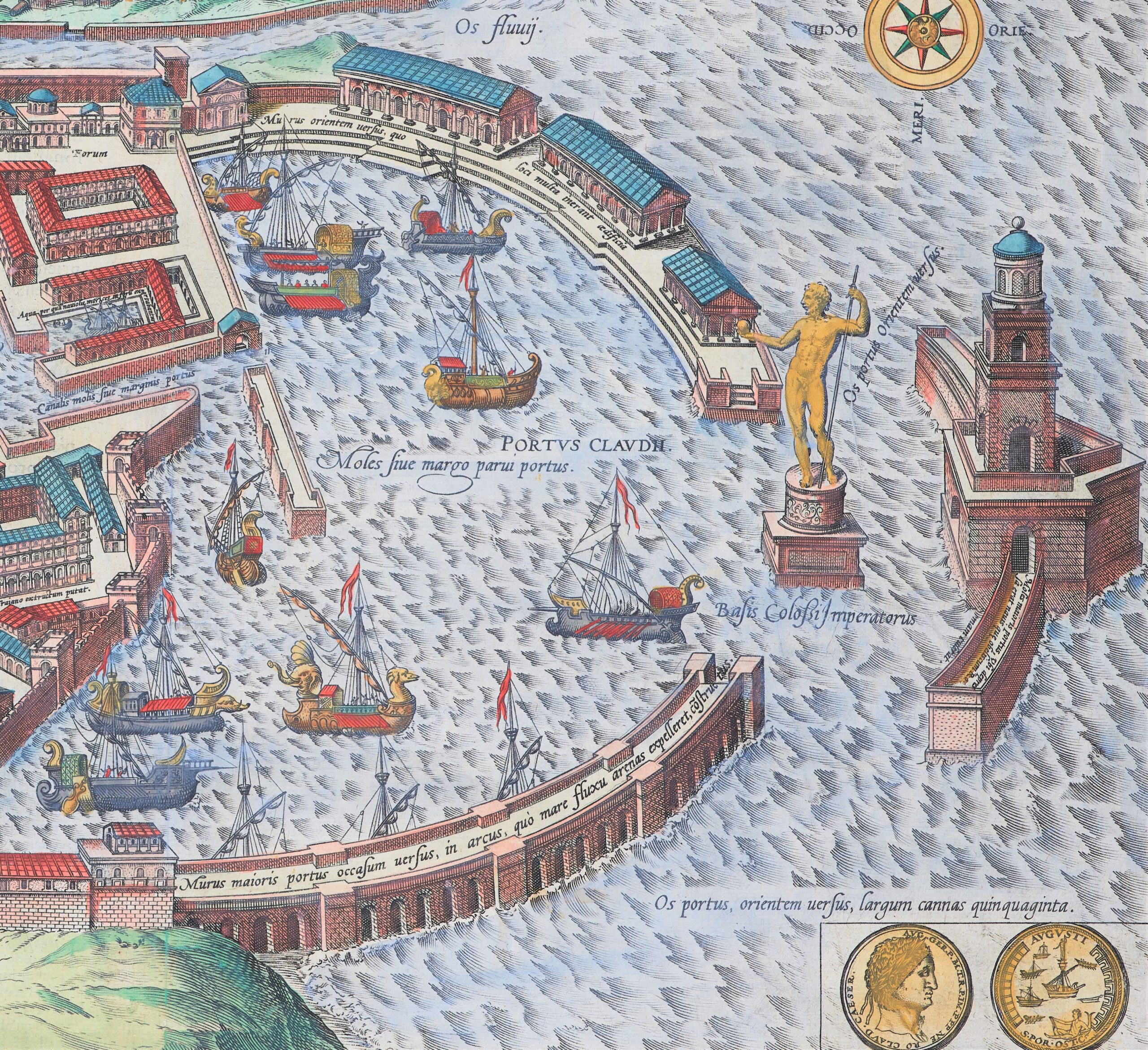
Detail
Date of first edition: 1588
Date of this edition: 1593-1595
Dimensions (not including margins): 29,5 x 49,5 cm
Dimensions (including margins): 41,5 x 53,5 cm
Condition: Strong print image with lovely old original colors and wide margins.
Condition rating: A
Verso: text in French. Key in Latin with numbers 111.
Map reference: Van der Krogt 3225; Taschen, Br. Hog., p. 335
From: Civitatis Orbis Terrarum (IV: Urbium praecipuarum totius mundi, liber quartus, first edition 1588)/Koeman B&H4. Van der Krogt 41:1-3
In stock
Portus commented by Braun
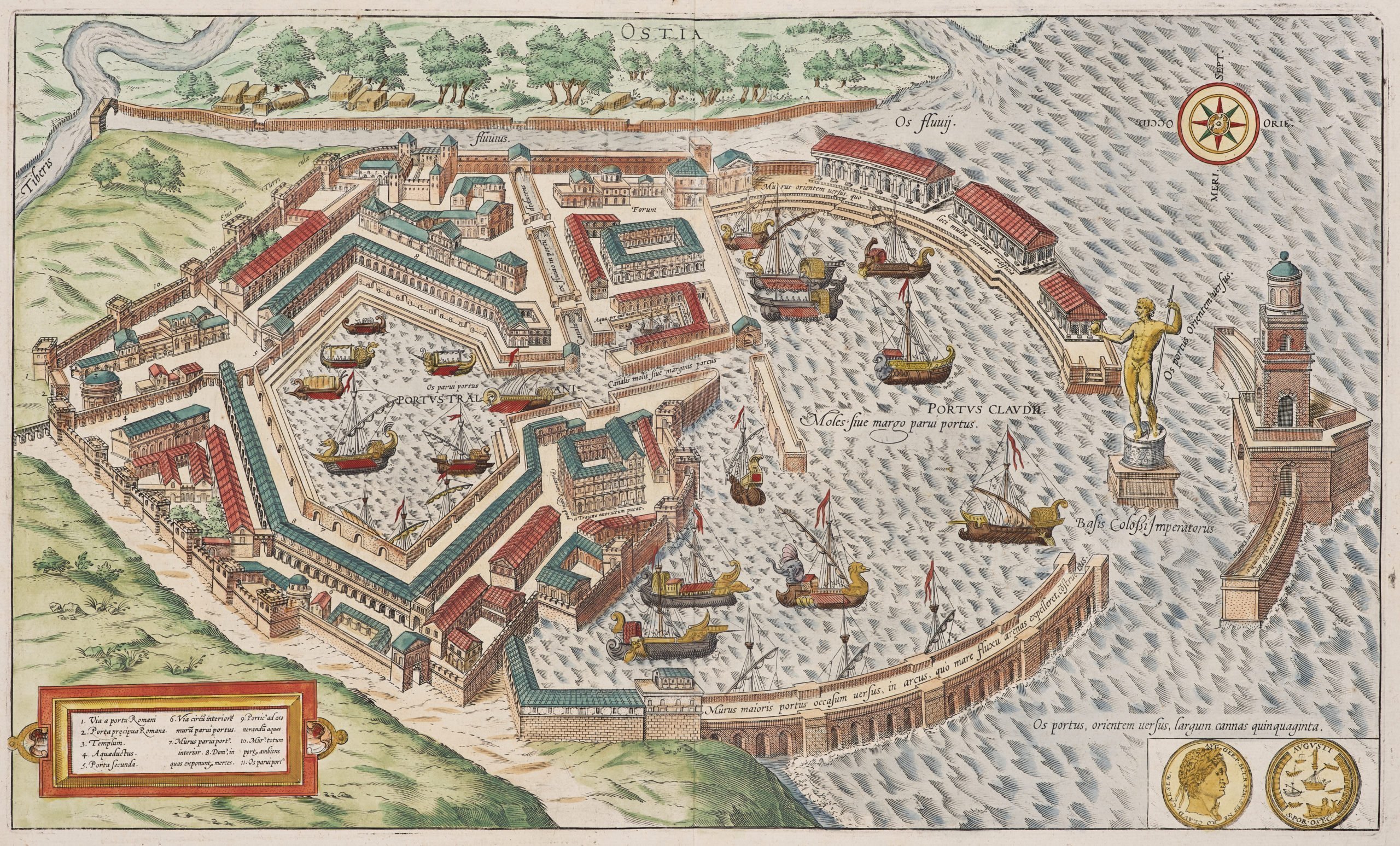
“The two ports situated near Ostia and shown here in plan view from an elevated position are believed to have been built by two different Emperors: namely that the larger egg-shaped one was built by Emperor Claudius; the adjacent, smaller hexgonal one, however, by the Emperor Trajan […]. The arm of the Tiber, which was dug by the ancient Romans for unloading goods brought into and sent out of the port, is approximately eight or ten ells across. The Tiber, on the other hand, measures 40 ells at its mouth, where the city of Ostia was built by Ancus Marcius, the fourth king of the Romans. So esteemed was it by the ancient Romans, although its climate is unhealthy, that it was exempt from usual taxes and duties.”
TRANSLATION OF CAPTION: Description of both harbours in Ostia, from the little book on the seas by Horatius Tigrinus.
Taschen on Portus
This is a bird’s-eye view from the north across the port of Portus, whose structure with the two basins, the mole in front and the colossal statue known from visual and literary sources has been reconstructed with astonishing accuracy. The spolia on the upper margin of the illustration refer to ancient Ostia. The first basin, the outer harbor, was laid out about 3 km north of what was the the mouth of the Tiber and a canal was dug to the Tiber. Construction work continued in the reign of Nero until AD 54. The city of Ostia, once the port of Rome and made much of in ancient sources as the place where Aeneas landed, was by this time almost 1 km inland because the Tiber had silted up. A second, hexagonal basin was added under Trajan. These measures were adopted primarily to secure grain supplies for Rome.


Ancient Portus
Portus was the imperial port [what’s in a French or English name] of ancient Rome, just a few km west of Ostia. This city was founded under Ancus Martius, Rome’s fourth king (reign from 641 to 616 BC). It mainly functioned as Rome’s harbor under the kingdom at the mouth of the Tiber. Ostium is Latin for mouth. However, at the end of the 1st century BC, the river was silting up, thereby landlocking Ostia. There was an urgent need for a bigger and more accessible harbor. Under the emperors Claudius and Nero an external part (the portus Claudii) was built between 42 and 62. Claudius placed an enormous lighthouse at the entrance of the port. Two canals connected the port with the river Tiber. Under Claudius the 24 km long Via Portuensis would also link Portus and Rome. In 62 (the same year as the eruption of the Vesuvius!) a storm destroyed 200 docked ships. A safer internal harbor was called for; so, Trajanus ordered the construction (from 110 to 112) of the inner basin to meet Rome’s demand of grain. At any given moment 160 ships could be handled. Most of the long buildings on this view were storage facilities. The hexagonal shape of this port is still visible in the landscape and is today called the Lago Traiano (just under the airport of Fiumicino; see picture). As for Ostia, it got city right in the 1st century AD with an estimated population of approximately 10.000 people. Isola Sacra (at the top of this map) was an island situated between Portus and Ostia.