Strait of Gibraltar
by
Johannes van Keulen
Detail
Date of first edition: ca. 1717
Date of this map: ca. 1717
Dimensions (not including margins): 57,5 x 51,3 cm
Condition: Very good. Strong paper and wide margins.
Condition rating: A+
Price (without VAT, possibly to be added): €1 350,00 (FYI +/- $1 498,50 / £1 201,50)
Unless otherwise specifically stated on this map page, we charge the following expedition costs in euro (unfortunatelly, gone up with Covid, but still too low in reality!):
– Benelux: 40 euro
– Rest of Europe: 60 euro
– Rest of the World: 100 euro
In stock
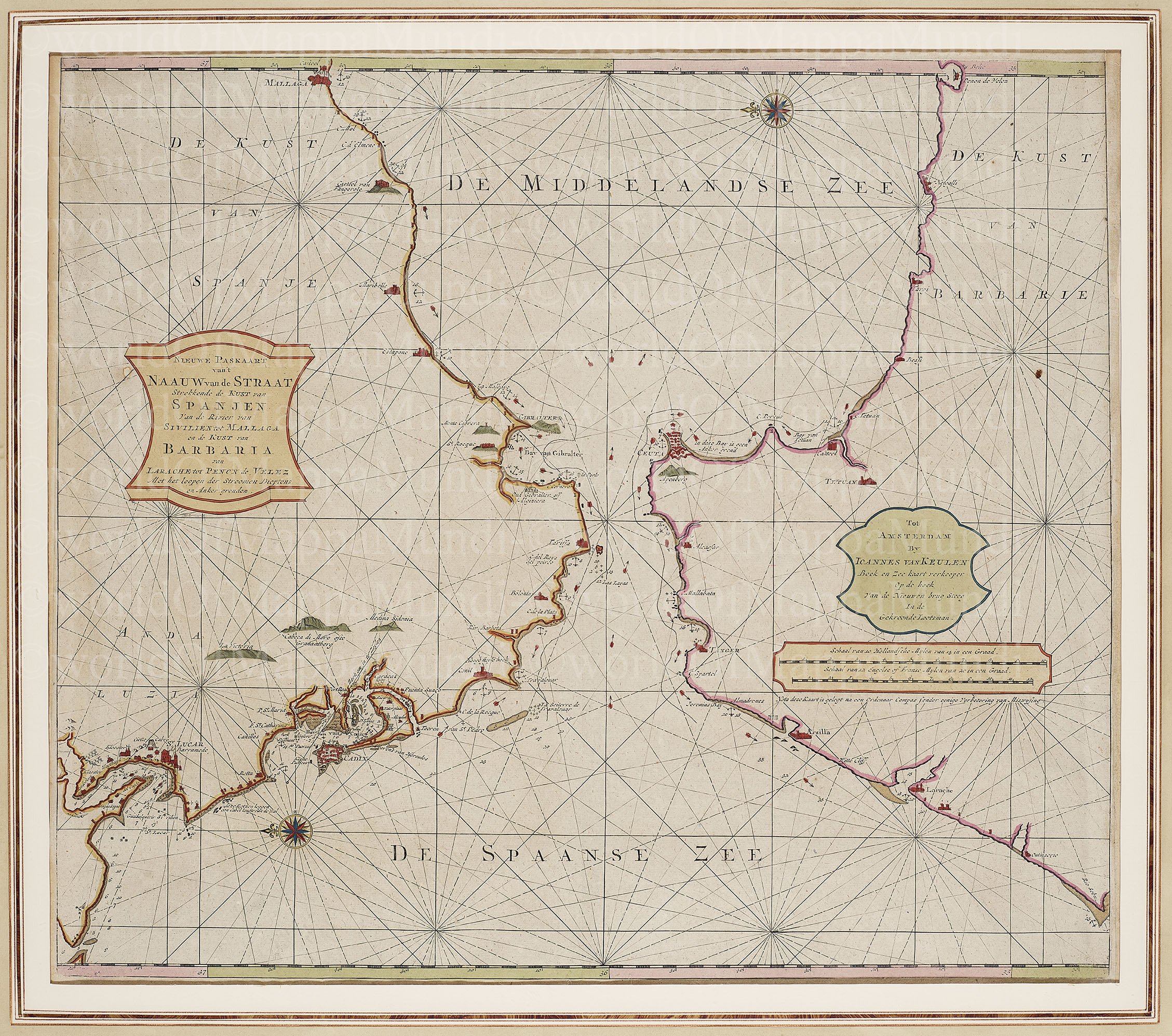
Original title: Nieuwe Paskaart van ‘t Nauw van de Straat Strekende de Kust van Spanjen…
The essence of a typical chart
De Nieuwe Paskaart van ‘t Naauw van de Straat Strekkende tot de Kust van Spanjen…. uit de Zee-fakkel van Johannes van Keulen is a typical chart. It is much larger than an normal map, not by accident. Also most detailed data of the land have been omitted. Full emphasis is placed on the compass directions and proper delineation of coasts. Spain is left, right lies Barbarie.
This map shows in detail the following: currents (red arrows), the depth of the sea, possible anchorages and sandbanks in brown. Would the big bank for Travalguar have played a role during the same battle on October 21, 1805?
Further noticeable are: the cities of Cadiz and Malaga, the Pillars of Hercules, and the peninsula Gibraltar (in British hands since the 1713 Treaty of Utrecht). This part of the Atlantic Ocean is called Spaanse Zee. On the other side lies Tetuan, Tanger and Ceuta (occupied by Portugal in 1415 and since the Treaty of Lisbon (1668) passed into Spanish hands).